КАТЕГОРИИ:
АстрономияБиологияГеографияДругие языкиДругоеИнформатикаИсторияКультураЛитератураЛогикаМатематикаМедицинаМеханикаОбразованиеОхрана трудаПедагогикаПолитикаПравоПсихологияРиторикаСоциологияСпортСтроительствоТехнологияФизикаФилософияФинансыХимияЧерчениеЭкологияЭкономикаЭлектроника
C. Read and translate the text.

England information file: Total population 49 mln. Capital - London. National day - St. George, April 23. National symbols - Red rose, lion, and bulldog. Language - English.
Of the four parts which make up Great Britain England is the largest and most densely populated part of the United Kingdom. The greatest concentrations of population are in London, Birmingham and north-west industrial cities.
England is mostly a lowland country. There are upland regions in the north and in the southwest, but the rest of England is almost flat. The coasts of England are washed by the North Sea, the Irish Sea, the English Channel and the Straight of Dover. There are many rivers in England. The longest is the Severn, the most important is the Thames.
Northwest England, the Midlands and Southern England – each part of England is different. The Lake District in Northern England with its lakes, mountains and valleys is a favorite holiday area. The Midlands contain major industrial centers of England as well as provide good plains for farming. Southern England is famous for some of the oldest British settlements and traces of ancient monuments such as Stonehenge. It is also where the capital of England is located, the city which being an important commercial and cultural centre dominates the life of Britain.

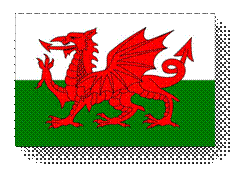
Wales information file: Total population – 2,5 mln. Capital – Cardiff. National day – St. David’s day, March 1st. National symbols – Dragon, leek, daffodil. Languages - English, Welsh.
It is the largest of the peninsulas on the western side of Britain. It consists of a complex of mountain ranges, which are called the Cambrian Mountains. The highest area occurs in the north, especially around Snowdon (1,085 m). In the upland areas sheep are the basis of the rural economy, and in the low-lying parts near the coast and in the valley bottoms dairy farming predominates.
The capital of Wales is Cardiff. It is an important industrial city and a port. It is also an administrative and educative centre.
The Welsh people, especially in rural areas, are fond of folk music, singing, poetry and drama. Welsh literature is one of the oldest in Europe.
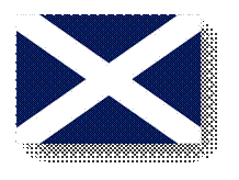
 Scotland information file: Total population – 5 mln. Capital – Edinburgh. National day – St. Andrew’s Day, November 30. National Symbols – Thistle, tartan. Languages - English, Scottish, Gaelic.
Although Scotland takes up one third of the territory of the British Isles it is not very densely populated mostly due to its northern location. Climatically the region has some of the most severe weather experienced in Great Britain. It is famous for its mountains. The Highlands of Scotland are among the highest mountains in the world. They reach their highest point in Ben Nevis (1,347 m). There are three lakes there, one of them, Loch Ness, is said to be the home of the “monster”.
The present-day economy of the region is dominated by agriculture. The region is clearly divided between the sheep pastures of the uplands & the more diversified farming areas of the lowlands.
The capital of Scotland is Edinburgh which is also the cultural centre of Scotland. It is associated with the names of George Gordon Byron and Walter Scott, Robert Luis Stevenson, Robert Burns and Arthur Conan Doyle.

Northern Ireland information file: Capital – Belfast. Patron saint - Saint Patrick. Languages - English, Irish, Gaelic. National Symbol – Shamrock.
The regional geography of the island is simpler than that of Great Britain, and especially than the regional geography of England. A large proportion of Ireland‘s territory consists of either uninhabitable mountain territories, or valleys & lowlands containing innumerable sheets of water. In the extreme north-east is the Antrim Plateau or Mountains of Antrim. Being geographically an island and a single unit, Ireland is politically divided into the Irish Free State & Northern Ireland or Ulster.
Дата добавления: 2014-11-13; просмотров: 369; Мы поможем в написании вашей работы!; Нарушение авторских прав |